|
|
|
|
|
|
|
|
|
|
|
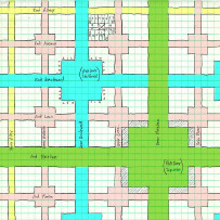

GALLERY
OF DESIGNS — click
a thumbnail for a larger version
Streets
![]()
![]()
![]()
![]()
![]()
![]()
![]()
![]()
![]()
![]()
![]()
![]()
![]()
![]()
![]()
![]()
|
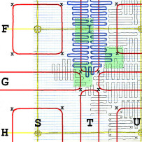
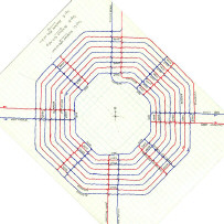
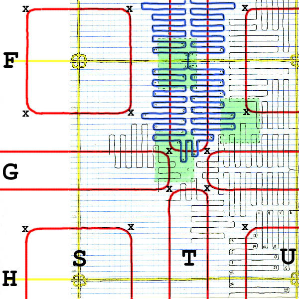
This city is a variation of the last. Here the parallel freeways (shown in yellow) run not only east-west but also north-south, four kilometers apart, to form a large grid. The letters down the left side indicate distance south, in 2-km increments, from the north edge of the city. Those across the bottom indicate distance east. It's assumed that rather than mere letters, the city would assign names. For example, “F, G, H” and “S, T, U” might be “Fresh, Gold, High” and “Sumac, Totem, Urchin.” So the east-west freeways shown here would be the Fresh Expressway and the High Expressway.
(TEXT
CONTINUED BELOW) Each freeway has interchanges, 700 meters apart, with connecting roadways shown in red: square Avenues and oval Boulevards. At each of the four corners of a connector is a landmark structure, indicated by an X, so that motorists will always be headed toward some visible goal. As in the previous plan, each connector is crossed repeatedly by a street which interfaces with driveways and parking lots. For one particular connector, Fresh Totem Boulevard, we've highlighted in blue the street, called Fresh Totem Street.
Three
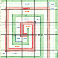
areas of this plan are shaded in green.
Below are enlarged views of those areas. |
|
|
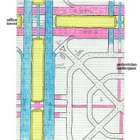
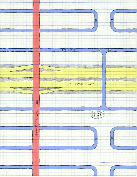
You might exit the Fresh Expressway (yellow) by taking the ramp up to West Fresh Totem Boulevard (red). It's "West" because it's the western side of the oval. Once you reached FT Boulevard, you'd be looking for a given address number on FT Street (blue). You'd need the help of signs to know whether to turn left or right on FT Boulevard and then where to turn off the Boulevard onto FT Street, where you'd find your destination.
|
|
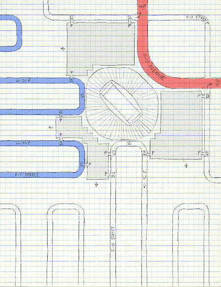
A football stadium is at the southwest corner of Fresh Urchin Avenue (in red). But you can't access the stadium directly from the Avenue. First you need to turn off the Avenue onto a Street. You might choose Fresh Urchin Street (upper right corner of this detail), which leads to the north and east parking lots (in gray). Or you can reach parking lots from Fresh Totem Street (in blue) or from Gold Urchin Street (at the bottom). Departing traffic is distributed over eight different street segments.
|
|
|
|
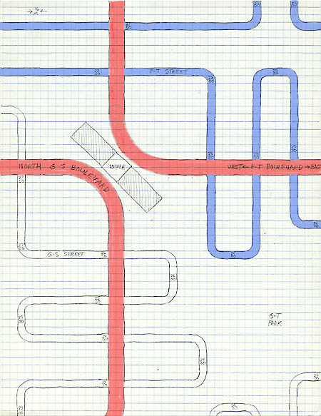
That object in the center isn't a Band-Aid. It's a landmark office tower, marking the bend in the road for motorists on both Fresh Totem Boulevard and Gold Sumac Boulevard. The southeast part of the tower could have addresses of 2370 FT Street (in blue) or 2630 GS Street (not colored); the northwest part, 2230 FT or 2730 GS. To the southeast of the tower (lower right portion of this detail), centered among four Boulevards, is Gold Totem Park.
|